Post-Christmas Storm Targets Philadelphia

Philadelphia, December 26, 2025 – As families across the Delaware Valley unwrap gifts and enjoy a mild, grey Christmas in the upper 40s, a distinct change is looming on the horizon. The unseasonably gentle weather is merely the calm before a sharp wintry turn, with meteorologists issuing a Winter Storm Watch that threatens to complicate post-holiday travel starting Friday afternoon.
The window of easy weather closes rapidly on Friday, December 26. While the morning will start with harmless clouds, the atmosphere is set to shift dramatically by evening. Around 5 p.m. just as many might be hitting the roads for post-Christmas dinners or returns snow will begin to push into the region. Temperatures are expected to plunge into the upper 20s, setting the stage for a messy night.
The storm won’t be a simple snowfall; it promises a chaotic mix. As Friday night progresses, Philadelphia will see a combination of snow and sleet, creating a wintry mix that notoriously wreaks havoc on traction. The precipitation is expected to persist through the overnight hours, turning untreated roads into potential skating rinks.
The impact of this system depends entirely on where you stand on the map. The storm is cutting a divide through the region:
North of the Valley: Areas in Bucks County, northern Burlington County, and north of the Lehigh Valley are bracing for the brunt of the winter impact, with accumulations estimated between 3 to 5 inches.
The City Center: Philadelphia itself is caught in the middle ground, looking at 1 to 3 inches of snow and sleet.
The South: For Delaware County, Chester County, and areas south of the AC Expressway in New Jersey, the precipitation will lean heavier on sleet and freezing rain, resulting in a slushy coating to an inch.
A Winter Storm Watch will be in effect for much of the region from Friday afternoon through Saturday morning. – National Weather Service
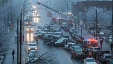
This official designation signals high confidence in hazardous conditions. It is a warning to motorists that the Friday evening and Saturday morning commutes will likely be dangerous, specifically citing the threat of icy road conditions as the mix freezes over.
By Saturday morning at 10 a.m., the worst will be over. The system will exit, leaving behind lingering flurries and a chilly afternoon with highs in the low 30s. While the accumulation might not be historic, the timing striking right in the middle of a major travel weekend makes this a storm to respect. Travelers are advised to get to their destinations before Friday evening or wait until the roads clear on Saturday afternoon.